FAQs
General
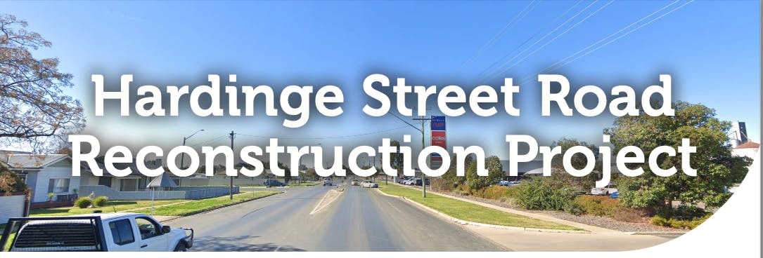
What is happening on Hardinge Street?
Edward River Council and Transport for NSW are upgrading Hardinge Street, between Ochtertyre and Harfleur Streets, to make it better and safer for all road users.
Work is happening in three phases.
When is the work happening?
Work is happening in three phases at various times between April 2025 and mid 2026.
What streets are affected?
A 936 metre section of Hardinge Street (COBB Highway HW21), between Ochterytre Street to Harfleur Street.
What to expect
When is the work happening?
At various times between April 2025 and mid 2026.
The two first stages of work will be carried out during normal work hours (Monday to Friday 7am - 6pm, Saturday 8am - 1pm).
Water shutdowns will be timed to have as little impact as possible, and are planned to occur between 9am and 3pm. You will be notified of timing by letter before this happens.
Stage 3 work may need to be carried out at night. We will advise nearby residents before this occurs.
What will the roadside look like?
We will be working along the sides of the roadway, near driveways and on the nature strips. Pedestrian access might be affected at times. At some times we will be working on the road with traffic control in place.
Will traffic be affected?
Traffic to businesses will be re-routed and flow may be affected. Please follow signage and traffic control directions.
Will I have access to my driveway?
Driveways to homes and businesses will remain open during watermain works and vehicle movements will not be affected. When new kerb and guttering and footpaths are being constructed, access to your driveway may be closed temporarily. We will advise affected residents.
Will there be much noise?
There will be some noise and minor vibrations associated with underground boring and construction of the new water main, as well as road paving. We will take steps to reduce this as much as we can.
What will happen to the trees and nature strips?
All existing trees are being retained, and there will be some new trees and shrubs planted. Nature strips will have disturbed soil backfilled so it is as near to pre-construction condition as possible. Further landscaping will be completed after the new kerb and gutter and road paving are complete.
Parking
Is parking affected by the roadworks?
Parking on your own property or in business carparks will not be affected. Some other parking on Hardinge Street will not be available during the construction work due to the need to maintain safe areas around the work site. At times, driveways to homes and businesses may need to be closed for short periods and this will affect vehicle movements. There will be alternative access points for businesses.
How will parking change when the project is finished?
After the project is complete, some of the places you used to park on the street may not be available. Designated parking bays for vehicles are being established in safe areas along the street.
Why is parking changing?
The new road has been designed to improve safety by adding channelised turning lanes and increasing “safe sight distances” at intersections.
This means it will no longer be safe to park in certain areas of the road as this impedes visibility for drivers.
Areas where you might have parked previously will change.
Areas that are safe for parking with be marked and signed.
Can I park outside my house?
Only if there is a marked parking bay. If you are concerned please contact the project team to discuss your situation.
How is my business affected?
Most businesses are not affected by the new parking bays, as their customer parking is off the road.
During construction there may be some impact on the way customers enter your business car parks. Your freight deliveries will not be affected. We will talk to you about this.
Where can trucks and caravans park?
When the road is complete there will be marked parking bays where trucks, cars and caravan/trailers can park. Most of the parking in the industrial area between Ochtertyre and Wood Streets has been retained.
Why had parking had to go?
Safety is the main consideration for this road project. Safe road design is mandated by the NSW Government.
This is a requirement for “Safe Interaction Sight Distance” at interactions so drivers can safely see along the road. Vehicle parking in these SISD areas blocks the view of drivers. So parking will no longer be available in these areas of the road.
We are creating channelised turning lanes which take up more width on the road that might have been previously available for parking.
There will be a new marked bus bay, wider intersections and new “bump dots” or Tactile Ground Surface indicators along the roadway near driveways to help people who are blind or vision impaired to navigate their surroundings.
Where can I park?
New parking bays for cars and trucks will be marked out in designated safe areas along the street. Most of this parking will be created in front of Memorial Park and from Ochertyre Street to the BP Truck Stop. A few new parks will be created in other safe areas.
Will there be timed parking restrictions?
At this stage timed parking is not planned to be introduced. Should this be required, consultation will be undertaken with affected businesses and residents.
Heavy Vehicles
How will the road design affect heavy vehicles?
The road has been designed to improve safety by adding channelised turning lanes and increasing “safe right distances” at intersections.
The road was designed in conjunction with Transport for NSW to comply with State Government safety and design regulations and the national Austroads Guide to Road Design.
Channelisation with new turning lanes and median strips will allow for the separation of turning and through traffic, creating more efficient and safer traffic flow.
New pedestrian crossings and tactile treatments will make pedestrians more visible.
Enhance lighting and new road signage will be in place.
How will channelisation affect trucks and Over Size Over Mass (OSOM) vehicles?
Safety is the main consideration for this road project. Safe road design is mandated by the NSW Government.
We are creating channelised turning lanes with raised medians to separate traffic and reduce the risk of rear end collisions and intersection accidents.
The road has been designed to accommodate OSOM vehicles with mountable medians, low profile kerbs, removable/layover signage, and the road widening at key intersections to accommodate heavy vehicle movements.
Is my business affected?
For property owners on Hardinge Street there may be some impact on the way customers and freight deliveries enter your business. We will take to you about this.
For trucks using the road, there may be some slight delays at times when construction work is happening on the road. We will advise when this is happening. Traffic management will be in place.
Where can trucks and caravans park?
When work on the road is finished, there will be marked parking bays where trucks, cars and caravan/trailers can legally park. Most of the parking in the industrial area between Ochtertyre and Wood Streets has been retained and marked for long vehicles.
Road Design
How has the road been designed?
The road was designed in conjunction with Transport for NSW to comply with State Government safety and design regulations and the national Austroads Guide to Road Design. The design also needed to comply with the TfNSW Road Space Allocation Policy and Procedure.
Why has a concrete median strip been incorporated in the design?
Hardinge Street has a high volume of road users, and a dual purpose as a corridor for through traffic and a local commercial, industrial and residential precinct. There is a mix of heavy vehicles (including B Doubles), freight vehicles, buses, cars, motorcycles, bicycles and pedestrians all using this area. The road needs to meet the minimum requirements outlined in the Austroads Guide to Road Design to ensure the safety of all these road users. These requirements include channelised right turn treatments incorporating a concrete median to keep traffic flowing, turning vehicles separated and pedestrians and cyclists safe.
How have pedestrians and cyclists been considered in the design?
To keep everyone safe, the new road will allocate space for all road users in accordance with TfNSW Road Space Allocation Policy and Procedure. When allocating road user space, the highest safety priority is for pedestrians, and then (in order) for cyclists, on-street public transport, freight, general traffic and on street parking for private motor vehicles.
Why is channelisation considered between Wood Street and Harfleur Streets?
The design for Hardinge Street Road Reconstruction Project outlined the inclusion of right turn lanes at the intersections of Ochtertyre Street, Harfleur Street and Sloane Street with Hardinge Street as part of the initial project scope.
Due to there being channelisation at either end of the works and the need to maintain parking facilities on Hardinge Street, a decision was made to include channelisation at Holden Court, Henry Street and Wood Street intersections with the Cobb Highway also.
This approach aims to minimise lateral shifts for through vehicles travelling on Hardinge Street, reducing potential driver confusion and ensuring a consistent cross-section for the limit of works. By optimising the layout of the main alignment, the design promotes a more intuitive and seamless experience for road users.
The addition of these channelisation also provides additional safety benefits through reducing the risk of rear-end collisions, as dedicated turn lanes separate turning movements from through traffic. Furthermore, the improved delineation of traffic flows reduces conflict points, contributing to safer and more efficient traffic operations.
Environmental Impact
What environmental impact will the proposed works have on the community?
The works may cause minor environmental impacts, such as noise, air pollution, and traffic delays.
Will the project affect the environment, and any endangered species in the area?
No, the environmental impact is low. Most vegetation affected is on the already disturbed road reserve. No mature trees are being removed, in fact we are planting many new trees and shrubs. The roadworks won’t affect any threatened ecological communities.
Will any trees be trimmed or removed during the works?
No mature trees will be removed. All mature trees will be identified and where necessary protected with physical markings such as night line or bunting.
Some already disturbed vegetation in the nature strips will be removed and replaced. We will plant new trees and vegetation on the nature strips to improve the aesthetics of the area. We estimate around 50 new trees and shrubs will be planted and 3,000m2 of nature strip restored or created.
Are there any places of cultural, historical, or social significance that will be affected by the works?
Searches confirm that no places or buildings with cultural, historical, or social significance will be affected by the proposed works.
Will any species of animals or plants be endangered by the project?
There will be some minor vegetation removal, but this will be limited to previously disturbed areas and is unlikely to significantly affect any protected fauna habitats. So the project isn’t expected to harm any plant or animal species.
Are there any long-term environmental effects expected from the roadwork?
The project is not expected to have any long-term environmental effects, as the area will be reinstated once the work is complete. In fact the road will have new landscaping and trees which will benefit the environment.
Will there be pollution because of the roadwork?
There could be some noise and dust, but it will be managed to keep it as low as possible.
What will happen to the waste from the project?
Most of the waste will be reused or recycled, and anything that can’t be used will go to a proper waste facility.
Bus Stop Changes
- no Council owned land to site the bus stop
- proposed stop not aligned with bus travel route
- pedestrians at risk of heavy vehicle movements
Where are the bus stops moving to?
Existing bus stops are in the map below. Due to safety concerns, the existing bus stop marked B will be moved to Wood Street. Exact timing for this move will be shared here and notice will be provided to bus users before the change occurs.

What other locations were considered?
The project engineers and the bus company operator (Dysons) considered five different alternative locations. Wood Street was preferred for its location on the bus route, proximity to shopping centre and ease of access for bus users.
Why were other locations rejected?
Other locations were rejected due to: